Prompt εικόνας Branding & UI Προσαρμόσιμα
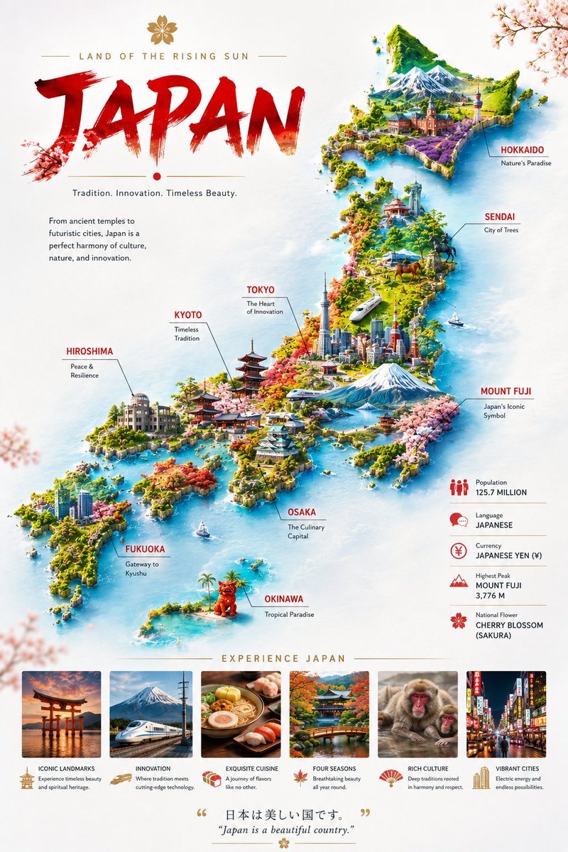
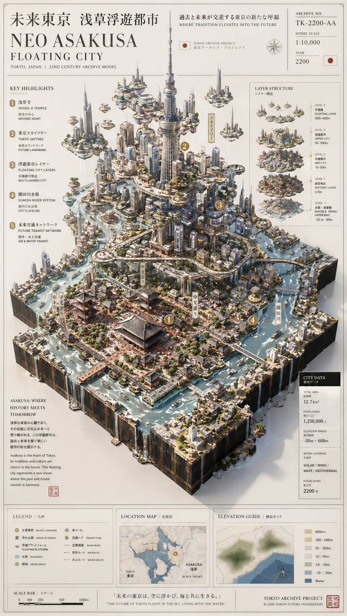
Αφίσα μακέτας πόλης με ανάγλυφο από αρχείο μουσείου
Ένας χαρτογραφικός πίνακας όπου μια πραγματική πόλη αναδύεται από τον επίπεδο χάρτη της ως ανυψωμένο τρισδιάστατο μοντέλο, με στρώματα εδάφους, μινιατούρες κτιρίων, γραμμές νερού και πάνελ αρχείου. Μοιάζει με έκθεμα μουσείου σε χαρτί ελεφαντοστού.

- Μοντέλο
- GPT Image 2
- Τύπος
- Εικόνα
- Αναλογία διαστάσεων
- 9:16
- Κοινοποιήθηκε
- 27 Απρ 2026
- Likes στο X
- 136
Όνομα πόληςΧώρα
Prompt εικόνας
1,759 χαρακτήρεςPlease create a high-completion, high-texture archival landscape model image based on the 【Theme】. This is not a normal map or illustration, but a premium museum-style visual combining 2D map drawing + 3D regional model + professional explanation system + collector poster aesthetic. The image must look like a real geography archive, urban planning model, architectural proposal board, or lost civilization research exhibit. Use a clean vertical 9:16 composition for social media feed. 【Theme】: [Replace with your idea — example: Neo Asakusa Floating City / Great Pyramids Hidden Archive / Machu Picchu Lost Civilization / Atlantis / Petra / Venice / Kyoto 2200] 【Theme Type】: Mixed Landscape 【Core Subject】: A giant central 3D model growing from a flat map board, showing the full environment with visible terrain, structures, water systems, roads, elevation layers, and architectural details. 【Visual Style】: Museum archive style + architectural proposal + worldbuilding collector poster + premium infographic 【Colors】: Clean bright premium colors, parchment white, ivory, warm beige, soft gray, moss green, muted gold, light blue water, red route lines, gold markers Avoid dark backgrounds and avoid black-heavy design. 【Structure】: Include contour lines, road networks, water systems, map borders, archive number, scale bar, legend area, title area, explanation modules, geographic labels, technical notes, and professional restrained typography. The center must be visually powerful and scroll-stopping. Use oblique overhead isometric view (30–45 degrees), showing both the flat map and the giant raised 3D main structure. Highly detailed, elegant, realistic shadows, premium paper texture, architectural model quality, cinematic masterpiece.
Prompt εικόνας
1,644 χαρακτήρεςCreate a premium real-world landscape archive model of [ CITY NAME ], [ COUNTRY ], inspired by museum-grade geographic research models. Transform the location into an elegant physical map board placed on soft white fabric, combining 2D cartographic drawing, 3D terrain model, architectural miniature, and professional archive infographic design. Main subject: [MAIN LANDMARKS, mountains, rivers, beaches, landmarks, bridges, islands, roads, coastline, districts, parks, monuments, famous buildings] The model must look like a real handcrafted architectural geography model: thick rectangular baseboard, visible layered terrain edges, raised terrain, carved coastline, miniature buildings, soft blue water, moss green vegetation, ivory paper map texture, contour lines, elevation zones, roads, routes, landmarks, scale bar, compass, legend, archive number, coordinate grid, location map, section diagrams, small technical notes, and museum-style labels. Use an oblique overhead isometric camera angle, 30–45 degrees, showing the full board, the 3D city relief, the terrain, the urban structure, and the explanation panels. Clean bright premium aesthetic, warm natural light, soft shadows, off-white background, parchment paper, subtle gold markers, blue hydrological lines, red route lines, restrained typography, highly detailed, realistic, elegant, tactile, professional, collector poster quality. Do not make it futuristic. Do not make it fantasy. Keep it based on the real place, but more beautiful, precise, and museum-worthy. Vertical 9:16 composition, ultra-detailed, premium geographic archive poster, scroll-stopping masterpiece.
Πώς να το χρησιμοποιήσετε
Αυτό το prompt λειτουργεί καλύτερα με ένα πραγματικό μέρος, οπότε αντικαταστήστε τα πεδία της πόλης, της χώρας και του ορόσημου μέσα σε αγκύλες με μια τοποθεσία που γνωρίζετε καλά. Κρατήστε το λεξιλόγιο του αρχείου μουσείου, την πλάγια ισομετρική κάμερα και την φωτεινή παλέτα περγαμηνής, καθώς αυτά δίνουν την εμφάνιση. Κοινοποιήθηκε ως prompt για το GPT Image 2, και η διάταξη 9:16 ταιριάζει σε ταπετσαρία κινητού ή ανάρτηση σε feed.
Κοινοποιήθηκε δημόσια στο X στις 27 Απρ 2026. Όλα τα credits για αυτό το prompt και το αποτέλεσμά του ανήκουν στον δημιουργό του. Είναι δικό σας; Ζητήστε ενημέρωση ή αφαίρεση.